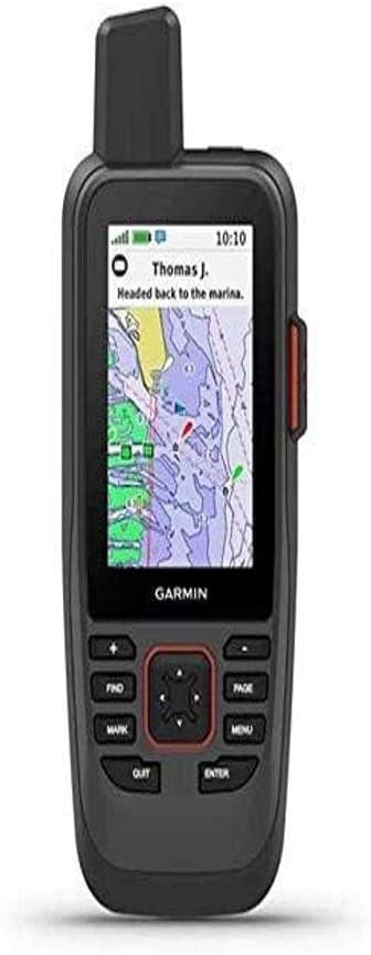
Garmin GPSMAP 86Sci
4.2Editor score
Preloaded BlueChart G3 Coastal Charts
InReach Satellite Communication Enabled
Streams Boat Data from Chartplotters
Finding the right handheld GPS for boating is crucial for safety and enjoyment on the water. A reliable device ensures you can track your position, navigate charts, and return safely even in remote areas without cellular coverage. Modern units offer rugged designs that float and resist water damage.
We compared ten leading models based on their mapping capabilities, satellite support, battery life, and ease of use. Our analysis focuses on real-world performance for marine environments, considering factors like chart preloading, durability ratings, and additional safety features such as SOS capabilities or companion apps.
Each pick below highlights specific strengths for different boating needs, from casual day trips to serious offshore adventures. Please note that product availability and pricing change frequently, so always verify current details before making a purchase decision to ensure you get the best value.
4.2Editor score

4.0Editor score

4.2Editor score
As an Amazon Associate we earn from qualifying purchases.
The following table provides a side-by-side comparison of all ten selected handheld GPS units. We highlight key specifications such as display size, battery duration, map support, and unique features to help you quickly identify which model aligns with your specific boating requirements.




The Garmin GPSMAP 79sc stands out as a top-tier marine GPS designed specifically for boaters who need reliable navigation and detailed charting. With a 4.0 rating, it balances robust features with user-friendly design, making it a standout choice for coastal exploration.
We may earn a commission when you buy through this link, at no additional cost to you.
Its preloaded BlueChart g3 coastal charts provide high-resolution data essential for safe navigation near shorelines. The device supports multiple satellite constellations including GPS, GLONASS, and Galileo, ensuring accurate tracking even in challenging environments like steep coastlines or areas with obstructions.
While it offers extensive memory for waypoints and routes, users should note that it lacks built-in two-way satellite messaging unless paired with external services. The rugged design and floating capability are critical for marine environments where accidental drops are common.
This unit is ideal for serious boaters who want a dedicated handheld device with superior mapping and durability. The combination of long battery life and precise altitude tracking via a barometric altimeter makes it a comprehensive tool for various marine conditions.
The preloaded BlueChart g3 charts offer detailed waterway data crucial for safe boating decisions.
Floating design and water resistance ensure the device survives unexpected immersion without damage.
We may earn a commission when you buy through this link, at no additional cost to you.
The Garmin GPSMAP 86Sci is a premium handheld GPS that integrates advanced satellite communication capabilities for enhanced safety on the water. With a 4.2 rating, it serves as a powerful tool for remote boating where traditional cellular coverage is absent.
We may earn a commission when you buy through this link, at no additional cost to you.
Its standout feature is the InReach technology allowing two-way text messaging and GPS-based location tracking via the Iridium network. Additionally, it can stream data from compatible chartplotters and instruments, consolidating marine system information into one handheld interface.
However, the satellite communication and weather features require a separate subscription which adds to the overall cost of ownership. While the unit is rugged and floats, users must manage the subscription costs to fully utilize its safety potential.
This device is best suited for offshore adventurers and commercial boaters who prioritize safety and connectivity. The ability to trigger an SOS and share locations with rescuers provides peace of mind during long voyages beyond visual range of land.
Iridium satellite network ensures communication is possible anywhere on the globe including remote oceans.
Streaming boat data allows this handheld to act as a portable dashboard for your vessel.
We may earn a commission when you buy through this link, at no additional cost to you.
The Garmin eTrex SE offers exceptional value for boaters who need a reliable navigator with extended battery life. Rated at 4.2, it provides robust performance for general navigation tasks without the high price tag of specialized marine units.
We may earn a commission when you buy through this link, at no additional cost to you.
Its standout feature is the impressive battery life of up to 168 hours in standard mode, powered by two field-replaceable AA batteries. This longevity ensures the device remains functional throughout multi-day trips without needing frequent recharging or battery swaps.
While it lacks preloaded marine-specific charts, it supports Multi-GNSS tracking for improved accuracy. The water-resistant design rated to IPX7 means it can withstand immersion, making it suitable for wet environments on a boat deck.
This GPS is perfect for budget-conscious boaters who prioritize battery endurance and basic navigation accuracy. It pairs well with smartphone apps for updates and planning, offering a flexible solution for casual and semi-serious water sports enthusiasts.
Up to 1,800 hours in expedition mode ensures readiness for months-long journeys without recharge.
Pairs with Garmin Explore app for easy trip planning and automatic cache updates.
We may earn a commission when you buy through this link, at no additional cost to you.
The Garmin GPSMAP 79s is a versatile handheld GPS designed for users who need reliable tracking anywhere in the world. With a 4.2 rating, it offers a robust set of features including a worldwide basemap and excellent durability for marine use.
We may earn a commission when you buy through this link, at no additional cost to you.
Unlike its 79sc counterpart, this model includes a worldwide basemap instead of specific coastal charts, making it suitable for global travel where detailed local chart data might not be preloaded. The device supports multiple satellite constellations for consistent performance.
The high-resolution color display and fogproof glass ensure visibility in bright sunlight conditions common on the water. Its floating design and IPX6 water resistance provide peace of mind against splashes or accidental drops overboard.
This unit is ideal for boaters who travel internationally or need a compact tracker without specific chart details. The combination of satellite diversity and rugged build quality makes it a strong contender for those prioritizing global coverage and reliability.
Worldwide basemap allows navigation across continents without needing regional data updates.
High-resolution display ensures map details remain clear even under direct sunlight.
We may earn a commission when you buy through this link, at no additional cost to you.
The Garmin eTrex 22x is a rugged GPS designed primarily for outdoor enthusiasts but performs well for casual boating trips. With a 4.3 rating, it offers reliable tracking and sufficient storage for mapping various terrains including coastal areas.
We may earn a commission when you buy through this link, at no additional cost to you.
Its preloaded Topo Active maps include routable roads and trails which can be useful for planning land-based access to waterways. The unit supports both GPS and GLONASS systems to improve tracking accuracy in environments where signals might be obstructed.
Battery life extends up to 25 hours using standard AA batteries which are easy to replace in the field. The micro SD card slot allows for additional memory expansion accommodating larger map sets for detailed regional navigation.
This device suits boaters who also enjoy hiking or need a dual-purpose GPS for land and water exploration. While it lacks specific marine charts, its robust build and long battery life make it a practical choice for general navigation.
8 GB internal memory plus micro SD slot allows downloading extensive map data without limits.
Rugged design withstands harsh conditions common in both hiking and boating environments.
We may earn a commission when you buy through this link, at no additional cost to you.
The Garmin GPSMAP 65 features advanced multi-band technology to deliver optimal accuracy in challenging environments. With a strong 4.5 rating, it stands out for its ability to maintain signal integrity even near steep coastlines or dense forests.
We may earn a commission when you buy through this link, at no additional cost to you.
Its large 2.6-inch sunlight-readable color display makes it easy to view navigation data while on the move. The included TopoActive maps provide detailed routing options suitable for general navigation and tracking waypoints during water excursions.
Multi-band technology helps the device filter out interference ensuring more reliable positioning than standard GPS units. Users can manage tracks and routes easily via the Garmin Explore website and app for a seamless experience across devices.
This model is recommended for users who prioritize signal accuracy and modern technology. While it is not designed exclusively for marine use, its robust satellite support makes it a dependable tool for navigating complex coastal environments.
Multi-band support ensures consistent tracking even in urban canyons or steep coastal terrain.
Garmin Explore compatibility simplifies data management and track reviews after trips.
We may earn a commission when you buy through this link, at no additional cost to you.
The Garmin GPS 73 is a specialized GPS designed to assist sailors with specific navigation needs. With a 4.4 rating, it offers dedicated sailing features that provide distinct advantages for competitive or recreational sailing activities.
We may earn a commission when you buy through this link, at no additional cost to you.
Its SAILASSIST capabilities include virtual starting lines and tack assist which help sailors optimize their performance during races. Additionally, it offers marine alarms for off-course alerts and Man Overboard MOB notifications which are critical for safety on the water.
While it has limited data storage compared to modern high-end units, it stores up to 1,000 waypoints sufficient for most local trips. The intuitive interface with dedicated backlit buttons ensures quick operation even in low light or stressful situations.
This unit is ideal for sailors who value specific features over high-tech charts. Its focus on safety alarms and sailing aids makes it a reliable companion for those who prefer straightforward and purposeful navigation tools.
Virtual start lines and tack assist provide real-time data to improve sailing strategy.
MOB and anchor drag alarms alert users to dangerous situations immediately.
We may earn a commission when you buy through this link, at no additional cost to you.
The Garmin eTrex 32x builds on the reliability of its predecessors with added sensors for enhanced environmental tracking. With a 4.2 rating, it serves as a versatile device for tracking elevation and direction alongside standard position data.
We may earn a commission when you buy through this link, at no additional cost to you.
It includes a 3-axis compass and barometric altimeter which provide accurate heading and pressure data. This makes it useful for monitoring changes in weather conditions or elevation while navigating coastal areas with varying topography.
Battery life reaches up to 25 hours powered by two AA batteries ensuring long operational periods. The 8 GB internal memory supports extensive map downloads for detailed route planning across different regions.
This unit suits users who need detailed environmental data in addition to basic navigation. Its rugged design and long battery life make it a practical option for explorers who need consistent performance on extended journeys.
Barometric altimeter tracks pressure changes to help anticipate weather shifts on water.
3-axis compass shows accurate heading even when the device is stationary.
We may earn a commission when you buy through this link, at no additional cost to you.
The Garmin GPSMAP 79sc Renewed offers a cost-effective way to access high-quality marine navigation tools. With a high 4.8 rating, certified refurbished units undergo rigorous testing to ensure performance meets original specifications.
We may earn a commission when you buy through this link, at no additional cost to you.
It includes the same preloaded BlueChart g3 coastal charts and rugged floating design as the new model. This ensures users get reliable charting and durability without the premium price tag of a brand new unit.
Buying a renewed product can significantly reduce costs while still providing access to advanced marine features. However, buyers should review warranty details carefully as refurbished items may have different coverage terms than new products.
This option is ideal for budget-conscious boaters who want top-tier performance. It combines the reliability of a certified product with substantial savings making high-end marine navigation more accessible to a wider audience.
Certified renewed products are tested to ensure they meet original manufacturer standards.
Renewed units provide significant savings while maintaining key functional features.
We may earn a commission when you buy through this link, at no additional cost to you.
The Garmin GPS 76 is a classic handheld GPS that provides essential tracking capabilities with proven reliability. With a 4.6 rating, it represents a straightforward solution for users who need basic navigation without complex charting requirements.
We may earn a commission when you buy through this link, at no additional cost to you.
Its WAAS enabled GPS receiver ensures accurate positioning by correcting signal errors from satellites. The device includes a trip computer that tracks current and average speed along with distance and timer functions useful for monitoring voyages.
Memory storage is limited to 1 MB but this is sufficient for storing essential waypoints and tracks. The use of standard AA batteries allows for easy replacement ensuring continuous operation during long trips without recharging options.
This device suits those who prefer simplicity and proven performance over modern high-tech features. Its straightforward interface and reliable tracking make it a practical choice for basic marine navigation needs.
WAAS technology improves position accuracy for safer navigation in open waters.
Integrated trip computer helps track distance and speed easily during travel.
We may earn a commission when you buy through this link, at no additional cost to you.
Selecting the right handheld GPS involves balancing features like chart support, durability, and battery life against your specific boating needs and budget.
Marine GPS units often come with preloaded coastal charts like BlueChart g3 which are critical for safe navigation. Ensure the device supports the level of map detail you need for your local waters or travel destinations.
Look for units that allow easy map updates via micro SD cards or software apps to keep your data current.
A device that floats is essential for boating to prevent loss if dropped overboard. Water resistance ratings like IPX6 or IPX7 ensure the unit can withstand splashes or brief immersion without damage.
Prioritize rugged designs with scratch-resistant glass and reliable seals to handle harsh marine environments effectively.
Long battery life is vital for extended trips where recharging may not be feasible. Units using AA batteries allow easy replacement while rechargeable options reduce waste over time.
Check battery specifications to ensure they meet the duration of your typical trips without needing frequent changes.
Modern GPS units support multiple satellite constellations such as GPS GLONASS and Galileo to improve signal reliability. Multi-band technology further enhances accuracy in difficult environments like steep coastlines.
Ensure the device uses WAAS enabled receivers to correct signal errors and provide precise positioning data.
Some advanced models offer InReach satellite communication allowing two-way messaging and SOS features. This connectivity is valuable for safety in remote areas lacking cellular coverage.
Consider whether you need these premium features or if basic tracking and waypoint sharing through smartphone apps are sufficient for your use case.
A sunlight-readable color display ensures you can see navigation data clearly even in bright outdoor conditions. Larger screens provide better visibility of maps and routes without excessive zooming.
Fogproof and scratch-resistant glass adds to the longevity and usability of the screen on a boat deck.
Features like compass altimeters and marine alarms for Man Overboard events add significant value for safety. Sailing assist tools can also help improve performance for competitive or recreational sailors.
Evaluate which specialized features align with your activities to avoid paying for unnecessary functionality.
Prices vary widely based on features and chart in so determine your budget before shopping. Premium units with satellite communication cost more but offer enhanced safety and global coverage.
Consider renewed or refurbished options to access high-end features at a lower price point while maintaining performance quality.
Before heading out on the water, fully charge your device or ensure it has fresh batteries. Install any necessary map updates and configure your waypoint preferences to match your planned route.
Keep the device in a secure location on the boat that is easily accessible yet protected from direct spray. Use the lanyard or mount provided to prevent accidental drops into the water during rough conditions.
After each trip, rinse the unit with fresh water to remove salt and debris. Store it in a dry place and periodically check battery levels and firmware updates to maintain optimal performance.
A handheld GPS is a portable device designed for personal tracking and general navigation, whereas a chartplotter is typically a fixed unit installed on a boat with larger displays and deeper integration with onboard instruments. Handheld units offer flexibility for shore excursions or backup navigation.
Yes, features like InReach two-way messaging and SOS require a satellite subscription service to function. Without a subscription, the device can still track your location but cannot send or receive messages or alerts via the satellite network.
Handheld GPS units rely on satellite signals which are available globally. However, for deep ocean navigation, units with preloaded open water charts and long battery life are recommended. Always carry backup navigation methods for open water safety.
Battery life varies by model and usage but typically ranges from 16 to 25 hours on standard AA alkaline batteries. Some devices offer extended battery modes that can last up to 168 hours for expeditions.
Many marine-specific handhelds are designed to float if dropped in water to prevent loss. Check the product specifications for buoyancy details since not all waterproof units are inherently buoyant without additional accessories.
Maps are usually updated using Garmin Express software on a computer or directly through the device via WiFi or micro SD card. Ensure your subscription is active if the maps require annual renewal for updated data.
Multi-GNSS support allows the device to use multiple satellite systems like GPS GLONASS and Galileo simultaneously. This increases the number of available satellites leading to better accuracy and faster location locking in challenging environments.
Many modern handhelds support sharing locations via smartphone apps when paired. Some premium models with satellite subscriptions offer real-time tracking directly to family members without needing cellular service.
Choosing the right handheld GPS for boating depends on your specific needs for chart detail durability and connectivity. The top picks like the Garmin GPSMAP 86Sci for premium features and the eTrex SE for value provide excellent starting points.
Prioritize features that directly impact your safety and navigation efficiency such as preloaded charts and long battery life. Investing in a device with proper water resistance ensures it withstands the demands of the marine environment.
Always check the current pricing and availability before purchase to ensure you get the best deal. Whether you choose a specialized marine unit or a versatile handheld, having reliable navigation tools is essential for every boating adventure.